In Nunapitchuk, a small town in northern Alaska, cracking homes, eroding soil, and persistent puddles illustrate the growing toll of thawing permafrost. Permafrost underlies about 15 percent of land in the Northern Hemisphere and has historically supported entire settlements. As temperatures rise fastest near the poles, thaw is destabilizing infrastructure and posing environmental hazards by releasing greenhouse gases, microbes, and heavy metals, fueling a feedback loop that worsens warming.
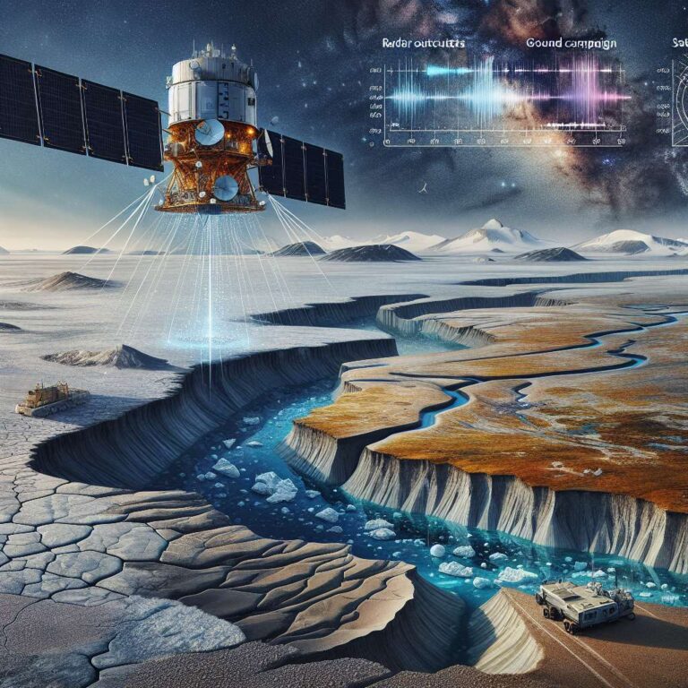
Scientists are now turning to satellites to quantify this change at scale. Building on work first published in 2012 by Kevin Schaefer, researchers use radar to measure seasonal ground heave and subsidence in the active layer, typically shifting by one to five centimeters. Expanded access to global data from government missions like the European Space Agency’s Sentinel and commercial providers like Iceye has moved permafrost monitoring from laborious field campaigns to automated, wide-area analysis.
At the University of Alaska Fairbanks, Simon Zwieback developed an algorithm that combines radar-measured subsidence with temperature records to infer where excess ground ice lies deeper below the surface. Warmer summers amplify surface movement, revealing ice-rich zones that are more likely to fail. The method produces maps that can help engineers and communities prioritize maintenance, construction, or relocation, addressing a key gap in distinguishing truly unstable areas from those with less risk.
Fieldwork remains essential for verification. In 2022, Zwieback’s team cored soil along Alaska’s Dalton Highway and found that satellite-inferred ice profiles matched lab measurements to about 1.1 feet depth, and deeper in a warm year, with known uncertainties near the surface and farther into permafrost. While ground campaigns can cost tens of thousands of dollars, running the algorithm on free satellite data costs only a few hundred. Limitations persist due to mixed conditions within single satellite pixels and undetected deeper excess ice, and the National Geospatial-Intelligence Agency has launched its own Frostbyte validation effort with federal labs.
The intelligence community’s interest reflects real-world stakes. Alaska hosts six military bases, 49 National Guard posts, and 21 missile-detecting radar sites, most vulnerable as 85 percent of the state sits on permafrost. Abroad, permafrost covers 60 percent of Russia, with thaw affecting more than 40 percent of buildings in northern regions, and critical assets in China are also at risk. On the civilian side, Schaefer’s Weather Stream and the Permafrost Pathways project are helping residents translate science into action. Working with towns such as Nunapitchuk, teams are combining radar data, local knowledge, and on-the-ground measurements to validate safer sites on higher, more stable ground. Radar’s ability to see through clouds is especially valuable in Alaska, enabling more reliable monitoring to guide decisions before failures occur.